Clarity
About
Writings icon
Blog Presentations Mastodon Publications
Projects icon
Overview Heron Mapping Client GeoHealthCheck – OGC GeoSpatial Web Service Monitoring Smart Emission – Open Sensor Web Platform Stetl – Streaming ETL NLExtract – Unlock Dutch Geodata INSPIRE FOSS – Free and Open Source for INSPIRE 7Scenes – create mobile games and tours MapGlow – heatmaps via WMS GeoSkating – map your inline skating tracks GeoRambling – Just’s Multimedial GPS Hikes Pushlets – PubSub via HTTP (stale) CowCatcher – Free Java Training Materials
Products icon
geotoko.nl - Ready Geodata map5.nl - Map Tiles geoqos.com - Hosted GeoHealthCheck
Contact
  • Adiós 2021

    Jan 4, 2022 · 13 min read · FOSS FOSS4G GeoFabriek GeoHealthCheck geoqos GeoSpatial geotoko.nl GIS GroteGeoShow Map5.nl NLExtract OSgeo OSGeo.nl python QGIS RTMP Streaming StreamYard  ·
    Share on:
    Adiós 2021

    Overview of my professional life in 2021. Highlights of living and working in the Open Source Geospatial and OSGeo(.nl |.org )-world in 2021. Organized by "Theme". Like 2020, 2021 was again a "special year" in pandemic terms. How to cope? Like Paul Ramsey writes: I feel like sharing some of my …

    Read More
  • That Was 2020

    Jan 20, 2021 · 10 min read · FOSS FOSS4G GeoFabriek GeoHealthCheck geoqos GeoSpatial geotoko.nl GIS GroteGeoShow Map5.nl NLExtract OSgeo OSGeo.nl python QGIS RTMP Streaming StreamYard  ·
    Share on:
    That Was 2020

    Overview of my professional life in 2020. Highlights of living and working in the Open Source Geospatial and OSGeo(.nl |.org )-world in 2020. Organized by “Theme”. Yes, 2020 was a “special year” in pandemic and political terms. So much has been written and opinions expressed, that I don’t see a need to add to more …

    Read More
  • Cheers to 2019

    Jan 17, 2020 · 7 min read · FOSS FOSS4G geonovum GeoSpatial GIS Map5.nl OSgeo python  ·
    Share on:
    Cheers to 2019

    Overview of my professional life in 2019. Inspired by the concise bullet-point-style of Tom Kralidis’ Cheers to 2018 , on which I based my previous Cheers to 2018. Highlights of living and working in the Open Source Geospatial and OSGeo(.nl |.org )-world in 2019. Organized by “Theme” i.s.o. by month. TL;DR. My 2019 …

    Read More
  • Cheers to 2018

    Jan 11, 2019 · 7 min read · FOSS4G GeoSpatial GIS NLExtract OSgeo PostGIS SensorThings SWE  ·
    Share on:
    Cheers to 2018

    Never too late to look back. Inspired by the concise bullet-point-style of Tom Kralidis’ Cheers to 2018 , my personal highlights of living and working in the Open Source Geospatial and OSGeo(.nl|org)-world in 2018. I’ll post 2019 reso’s later. Not just personal projects, but also events from the OSGeo.nl Local Chapter …

    Read More
  • Emit #1 – Into Spatiotemporal

    Jan 20, 2018 · 6 min read · air quality FOSS FOSS4G gdal geoserver GeoSpatial GIS NLExtract PostGIS sensors SensorThings SOS stetl  ·
    Share on:
    Emit #1 – Into Spatiotemporal

    One of my new year’s resolutions for 2018 was to “blog more”. Not being very active on the well-known social media: a bit tired of Twitter, never really into Facebook, bit of LinkedIn. OSGeo mailing lists , GitHub and Gitter is where you can find me most (thanks Jody, for reminding!). And I read many blogs, especially …

    Read More
  • Dances with the GeoPython Tribe

    Jul 13, 2016 · 4 min read · basel Cesium FOSS FOSS4G gdal geodjango geonode geop GeoSpatial GIS grass OSgeo python stetl  ·
    Share on:
    Dances with the GeoPython Tribe

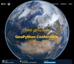
    During June 21-24, 2016 I attended the very first GeoPython Conference in Basel Switzerland . This event was organized by the Institute of Geomatics Engineering of the FHNW – University of Applied Sciences and Arts Northwestern Switzerland and PyBasel , the local Python User Group Northwestern Switzerland. In …

    Read More
  • Deploying Open Source Geospatial Software – Part 1: Challenges

    Jun 10, 2016 · 5 min read · docker FOSS4G gdal GeoSpatial GIS ogc OSgeo packaging  ·
    Share on:
    Deploying Open Source Geospatial Software – Part 1: Challenges

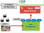
    My blog has been quiet for some time. As many of us I’ve been busy doing projects, all involving Open Source Geo (OSGeo) software. Partly development, writing software, I love it, but also more and more in “what comes next”: deploying and maintaining “the application” with all of its dependencies. For this I have been …

    Read More
  • Unlocking Sensor Data – I’ll send an SOS to the world

    Oct 1, 2015 · 3 min read · FOSS4G geonovum GeoSpatial iot ogc OSgeo SensorThings SOS standards SWE  ·
    Share on:
    Unlocking Sensor Data – I’ll send an SOS to the world

    Revealing: the title refers, for the younger readers, to a great 1979-hit by The Police as expanded below. To be played at the loudest possible volume. If you don’t see anything here below try the YouTube link directly: One of the main aspects that glues the OSGeo-world together are OGC-standards: WMS, WFS, WMTS, WCS …

    Read More
  • 3D Geospatial – Open Standards – v0

    Jan 29, 2015 · 12 min read · 3D 3DPS BIM Cesium COLLADA FOSS4G GeoSpatial GIS ogc OSgeo X3D  ·
    Share on:
    3D Geospatial – Open Standards – v0

    This is my evolving overview of 3D Geospatial Open Standards with a focus on web technology: services, HTML5, WebGL. These are notes I keep within Evernote as part of the 3D Geospatial Notebook whose public link is: https://www.evernote.com/pub/justb4ever/3d-geospatial. For sure, resources are missing, let me know. …

    Read More
  • 3D Geospatial – Free and Open Source Software v0

    Jan 28, 2015 · 5 min read · 3D 3DPS Cesium D3JS FOSS FOSS4G gdal GeoSpatial ogc OpenLayers OSgeo OSLandia PostGIS ThreeJS  ·
    Share on:
    3D Geospatial – Free and Open Source Software v0

    This is my list of FOSS products for 3D Geospatial with a focus on web technology/WebGL and Open Standards. These are notes I keep within Evernote as part of the 3D Geospatial Notebook whose public link is: https://www.evernote.com/pub/justb4ever/3d-geospatial. This is also the first experiment to auto sync Evernote to …

    Read More
    • ««
    • «
    • 1
    • 2
    • »
    • »»

Just Objects B.V.

is the trading name for the professional activities of Just van den Broecke.
Read More

Recent Posts

  • Adiós 2021
  • Terraform - First Steps on Hetzner Cloud
  • That Was 2020

Categories

PROJECTS 36 OSGEO 34 SOFTWARE 32 GENERAL 23 MOBILE 13
All Categories
GENERAL23 MEDIATECH5 MOBILE13 OSGEO34 PROJECTS36 SMARTEMISSION8 SOFTWARE32
[A~Z][0~9]

Tags

GEOSPATIAL 18 OSGEO 18 GIS 14 FOSS4G 11 FOSS 9
All Tags
3D2 3DPS2 AIR-QUALITY1 AIRQUALITY1 AIRSENSEUR1 ANSIBLE1 BASEL1 BIM1 CESIUM3 COLLADA1 COLORADO1 D3JS1 DENVER1 DEVOPS1 DOCKER2 EPGS289921 EVOLUTION1 FOSS9 FOSS4G11 GDAL7 GEODJANGO1 GEOFABRIEK2 GEOHEALTHCHECK2 GEONODE1 GEONOVUM2 GEOP1 GEOQOS2 GEOSERVER3 GEOSPATIAL18 GEOTOKO.NL2 GIS14 GITOPS1 GPS1 GRASS1 GROTEGEOSHOW2 IOT3 JPEG1 LORA1 LORAWAN1 MAP51 MAP5.NL5 MAPNIK1 MAPPROXY1 MAPSERVER1 NATURAL-NAVIGATION1 NIJMEGEN1 NLEXTRACT6 NLTOPO1 OGC7 OPENLAYERS1 OPENSTREETMAP1 OPENTOPO2 OSGEO18 OSGEO.NL2 OSLANDIA1 OSM2 PACKAGING1 POSTGIS6 PROJ1 PYTHON6 QGIS3 RASPBERRY-PI2 RTMP2 SENSORS1 SENSORTHINGS8 SENSORWEB1 SOS6 SOTM1 STANDARDS1 STETL2 STREAMING2 STREAMYARD2 SWE6 TERRAFORM1 THETHINGSNETWORK1 THREEJS1 TILECACHE1 TOP10NL1 WEATHER3 WEATHER-UNDERGROUND3 WEEWX3 WFS1 WMS3 X3D1
[A~Z][0~9]
Clarity

Copyright  CLARITY. All Rights Reserved